[

      {
        "name": "Top Stories Video Pair",
        "insertPoint": "7",
        "component": "17087298",
        "parentWrapperClass": "fdn-ads-inline-content-block",
        "requiredCountToDisplay": "1"
      }

    ]
Ready for your holiday geography quiz? Cover the bottom of this column, and we're off:
1. What's the closest foreign land? To avoid Eureka-Arcata favoritism, we'll measure from ACV, a.k.a. McKinleyville airport. How far away is it, to the nearest 100 miles?
2. How about the second- and third-closest foreign countries to ACV?
3. What's the highest point in Humboldt County? Extra points for elevation, to closest 1,000 feet.
4. If (when?) the Greenland ice cap and the West Antarctic ice sheet are both completely melted, raising the sea level by 40 feet, would CR be under water? Would Myers Flat still be Where It's At?
5. Is Humboldt County wider (east-west) than it is long (north-south)? How many counties does Humboldt border?
6. Go due north 100 miles from the Eureka gazebo (Second and F). Now go 100 miles due east, 100 miles due south, and 100 miles due west. Do you end up back at the gazebo? If not, then where?
Answers:
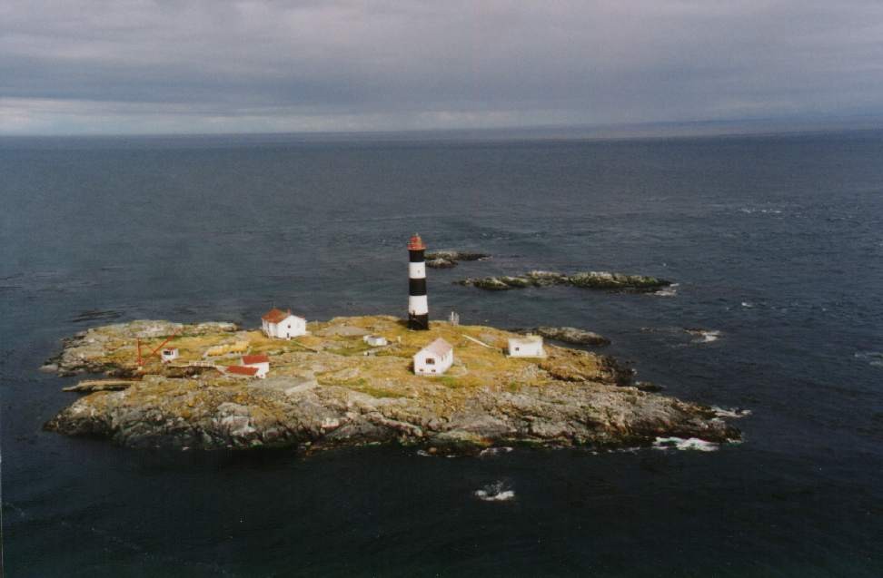
1. Canada is the closest foreign land, eh? (not counting embassies in San Francisco!). Race Rocks (photo) off the southern shore of Vancouver Island, British Columbia are 506 miles north of us, closer than LA.
2. Second is Mexico. La playa at the border, near Tijuana, is just under 700 miles wouth. Russia comes in third. The closest Russian territory is Big Diomede Island (see "Field Notes," April 8), about 2,440 miles north by northwest -- equidistant with, e.g., Jacksonville Fla., and roughly 100 miles short of the next country, Guatemala.
3. Highest point is Salmon Mountain in the Klamath Mountains, a tad under 7,000 (6,962) feet.
4. CR's parking lot would be submerged, but the campus would be prime waterfront property. Myers Flat is safe; it's between 150 and 200 feet above present sea level.
5. Humboldt County, all 4,000 square miles of it, is about twice as long as it is wide. We border four other counties: Del Norte, Siskiyou, Trinity and Mendocino.
6. The latitude of the gazebo is about 40.80 degrees north (of the equator), where one degree of longitude = 52.44 miles. 100 miles north of the gazebo puts you in the middle of Curry County, Oregon, at a latitude of about 42.25 degrees, where one degree of longitude yields 51.28 miles (lines of longitude converge towards the North Pole). By the time you get back to the latitude of the gazebo after your 400-mile excursion, you'll be 1.16 miles east of where you started, so now you'll be ... let's see, right in front of the pharmacy counter at Target. You may need an Advil after all that.
Barry Evans ([email protected]) defines "winning" as having visited more countries than your age in years. Check out his books at Eureka Books and his travel photos at Old Town Coffee & Chocolates.

more from the author
-
Doubting Shakespeare, Part 1: Stratfordians vs. anti-Stratfordians
- Apr 25, 2024
-
A Brief History of Dildos
- Apr 11, 2024
-
Eclipse!
- Mar 28, 2024
- More »
Latest in Field Notes


Readers also liked…
-
Trouble on the Line: The Reality Part 2
- Nov 3, 2022


