Wednesday, September 16, 2020
Crews Still Keeping August Complex Out of Humboldt
Posted By Kimberly Wear @kimberly_wear on Wed, Sep 16, 2020 at 1:53 PM
The fire has not jumped the Eel River or made its way into Humboldt County.
"Fire crews continue seeing positive developments in the West Zone of the fire and continue working today to solidify containment lines for the northwest section of the fire near Humboldt County," an update from Humboldt County Office of Emergency Services states, noting that acres total was reduced "due to some acres being counted twice in early Cal Fire reports."
Read the full update here.
The post also states CalFire "has not set a date or time for the lifting of Humboldt County evacuation orders," which remain the same as do evacuation warnings for portions of Southern Humboldt.
However, licensed farmers can receive day-passes from the county Planning and Building Department to get past roadblocks in evacuation areas to check on crops and livestock. (Read more here.)
Evacuation orders include areas south of Casterlin Road, including all properties on Casterlin Road, to the Mendocino / Trinity County Line and east of Dyerville Loop Road and Bell Springs Road to the county line.
Evacuation warnings are in effect for all areas west of Bell Springs Road to Highway 101 spanning from Elk Creek Road / Dyerville Loop Road to the Mendocino / Trinity County Line in Southern Humboldt County and all areas east of Alderpoint Road spanning from State Route 36 to Casterlin Road, not including all properties on Casterlin Road.
Maps of evacuation zones and routes are available at humboldtgov.org/evacmap or humboldtsheriff.org. The Humboldt County Emergency Operations Center continues to staff a Fire Evacuation Information Line at 707-268-2500 for questions regarding current county evacuations and resources.
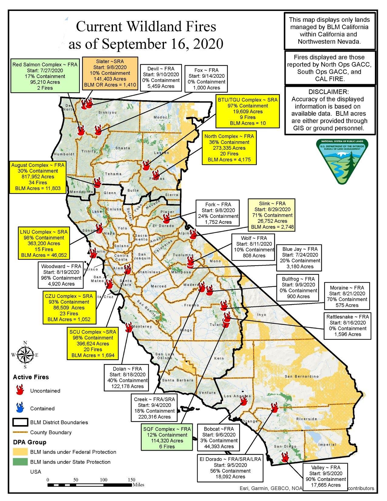
The entire August Complex is now at nearly 797,000 acres with 30 percent contained.
The Humboldt County Sheriff’s Office of Emergency Services will notify residents of new orders or warnings via Humboldt Alert, online at humboldtsheriff.org and on the HumCoOES social media pages.
Evacuees are directed to contact the Humboldt County Fire Information Line at 707-268-2500 to be connected with assistance related to wildfire displacement.
If local wildfire evacuees have specific service needs, they may call the American Red Cross Sheltering Services: 530-276-8034 and Livestock and Small Animal Sheltering: 707-599-1734.
Road Closures
The following roads remain closed: Alderpoint Road from Fort Seward Road to Dyerville Loop Road. Bell Springs Road from Alderpoint Road to the countyline.
How to Help
- GoFundMe for Trinity County’s Southern Trinity VFD. Click here.
- If you would like to donate, the addresses for Southern Humboldt Fire Departments can be accessed by clicking here.
- To volunteer or donate to assist regional wildfire evacuees, please contact:
- Pay it Forward Humboldt
- Volunteer: 707-499-2364
- Donation: 707-499-3840
- [email protected]
- Humboldt Area Foundation
- American Red Cross
- Humboldt CERT
- Pay it Forward Humboldt
Speaking of...


Comments
Showing 1-1 of 1
Readers also liked…
About The Author
Kimberly Wear
Kimberly Wear is the assistant editor of the North Coast Journal.
more from the author
-
Dust to Dust
The green burial movement looks to set down roots in Humboldt County
- Apr 11, 2024
-
Our Last Best Chance
- Apr 11, 2024
-
Judge Rules Arcata Can't Put Earth Flag on Top
- Apr 5, 2024
- More »


