February 14, 2013
By the Breach
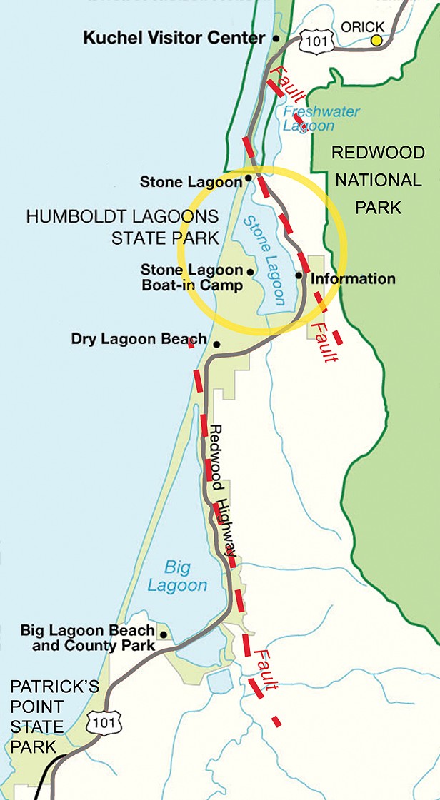
Sources: Mark Hemphill-Haley, Google Maps, california state parks
Map of the lagoons in Humboldt Lagoons State Park. The dashed lines show, roughly, the locations of fold-and-thrust faults that created the basins where the lagoons have formed.
Additional Slideshows


Comments
Showing 1-1 of 1