


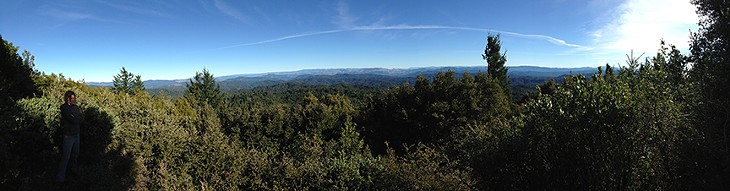
- Photo by Ken Burton
- View from the trail up the Chemise Mountain.
[

      {
        "name": "Top Stories Video Pair",
        "insertPoint": "7",
        "component": "17087298",
        "parentWrapperClass": "fdn-ads-inline-content-block",
        "requiredCountToDisplay": "1"
      }

    ]
Stands of manzanita and groves of knobcone and sugar pine grow within sight of the ocean. Redwoods are nearly absent. Golden eagles ride the thermals along the ridges, and you can find rattlesnakes right down to the edge of the beach. All this makes exploring the King Range National Conservation Area a unique experience in Humboldt County.
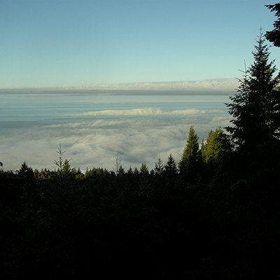
This, the nation's first national conservation area, is a 60,000-acre wilderness of former ranch and timberlands administered by the Bureau of Land Management. The range's position and topography combine to produce a climate very different from those of adjacent coastal areas. Because the prevailing summer winds are from the east-northeast instead of the west, coastal fog is kept at bay (at ocean, really), so summer moisture is scarce, fire is frequent, and the range supports fire-adapted plant communities not found elsewhere so close to the coast.
When people imagine hiking in the KRNCA, thoughts often turn to multi-day slogs along the Lost Coast (timed to avoid high tides) or grueling, sun-baked mountain treks requiring car shuttles between trailheads on the King Crest. As the BLM's trail map puts it, "miles in the King Range do not come easy." However, if you're looking for something a little less challenging, there are several rewarding day hikes. Perhaps the easiest and most accessible is the one up Chemise Mountain in the southern part of the park. You barely even need to leave pavement to get to the trailhead.
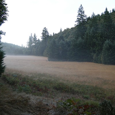
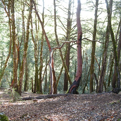
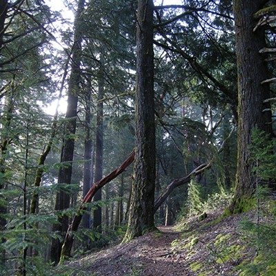
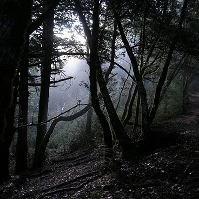
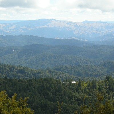
The backbone of the hike is an inland portion of the Lost Coast Trail. You start at the Hidden Valley Trailhead in the valley of South Fork Bear Creek, a tributary of the Mattole River. A short distance out, the trail passes Hidden Valley, a lovely meadow complex where you sometimes can see Roosevelt elk, before climbing through a dense, gloomy, regenerating forest to a ridge. On the ridge, the forest is more mature and open; look for the rectangular excavations on tree trunks that mark the work of pileated woodpeckers. Eventually you come to a brushy gap with a spectacular vista of the ocean; linger here a bit and savor the view and the sunshine before reentering the forest.
Stumps and fire scars illustrate two major forces that have shaped the King Range landscape. In places you pass the skeletons of manzanita bushes that, after logging and subsequent fire suppression, were shaded out and killed by fast-growing Douglas-fir. It all makes you long to know what the area looked like originally.
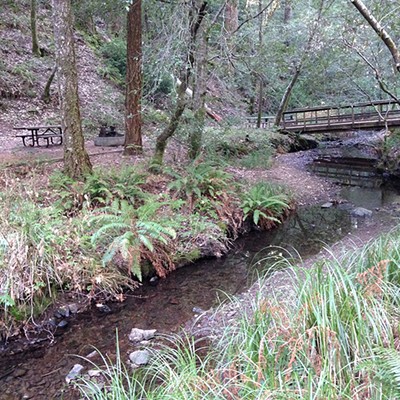
Two miles from the start is a junction where you have a choice. The summit of Chemise Mountain is less than a mile ahead, but for a pleasant detour, turn left here and drop back down to Bear Creek. You'll notice an almost immediate change in the vegetation once you leave the wind-exposed ridge and enter the cool, moist canyon. Turn left again at the next junction to Nadelos Campground, which makes a great base for exploring the area with eight secluded walk-in sites. A nature trail follows the creek upstream (to the right) a short distance; interpretive signs discuss the lives of the Mattole and Sinkyone tribes, who inhabited the area prior to the arrival of whites.
Follow the signs for Chemise Mountain, passing the first two junctions on the way. A short spur trail takes you to an overlook at the summit where you have a 180º view east across the Mattole and Eel valleys all the way to the Yolla Bolly-Middle Eel Wilderness. Marijuana nurseries on private lands dot the hills below you. A bench here makes this a fine lunch spot.
If you're up for more walking before heading back, continue a short distance along the ridge to the Chinquapin Loop, named for an oak that grows locally. Turn right and follow the trail down the coastal side of the ridge with frequent views of the ocean, crossing several small streams, passing a primitive campsite, and actually dipping into Mendocino County before returning to the Lost Coast Trail.
Be forewarned: Your first hike in the King Range is likely to whet your appetite for more. Despite — or perhaps because of — the distance and the challenges, you'll find yourself drawn back again and again. Like many of the range's trails themselves, it's a slippery slope.
Getting there: Take Briceland Thorn/Shelter Cove Road from Redway 17 miles west. Turn left on Chemise Mountain Road and go ¼ mile to the trailhead access on the right.
Roundtrip hike length: 5 miles with neither loop, 7 miles with campground loop, 8 miles with Chinquapin loop, 10 miles with both loops.
No fee and no bicycles. Dogs must be under voice control and restrooms are available in the campground.
Ken Burton is co-writing Hiking Humboldt, to be published next year.
Speaking of...
-
David's Chair Blazes Accessible Trails in Prairie Creek Redwoods
Oct 5, 2023 -

Wind Power, Dreamy Dunes and Cool Carrots
Jul 28, 2023 -

Ode to the Wooden Walking Stick
Oct 20, 2022 - More »
more from the author
-
The Road Not (Yet) Taken
A tour of the Eel River Estuary Preserve
- May 15, 2014
-
Down for the Count
Christmas birding with the Audubon Society
- Dec 12, 2013
- More »
Latest in Get Out


Readers also liked…
-
A Walk Among the Spotted Owls
- Apr 27, 2023


